
The Development of Maps Unique
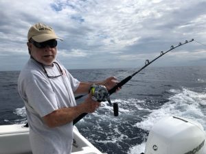 Maps Unique, was founded in 1988 by Captain Chip Berry, a passionate offshore fisherman from Marion, SC splitting his time between his family’s home in Marion and their home in Murrell’s Inlet, SC. Chip’s love for the open water runs deep – for over fifty years, he, his father, and his brothers have chased marlin and other pelagic species across the deep blue waters aboard their cherished 42-foot Hatteras, the “Berry-Cuda V.”
What started as a personal project soon charted a new course. In those early days, Chip, a charter boat captain, began gathering information on prime offshore fishing habitats along the Southeastern U.S. coast. The project was meant for the Berry family and their fishing team — but word traveled fast. Friends and fellow fishermen would stop by, eager to get a glimpse of Chip’s growing collection of fishing spots, which they soon nicknamed the “unique maps.” Their curiosity and encouragement sparked an idea: why not share this with other anglers? And so, Maps Unique was born.
Chip was a true pioneer. He was the first to produce a Loran-based bottom contour set of hardbottom fishing maps for the Southeast, and later, the first to transition those maps to GPS as technology evolved. His years at sea provided the perfect foundation for meticulously researching and plotting offshore habitats. Using detailed bathymetric maps as a base, he identified ledges, troughs, ridges, and natural limestone outcrops — critical areas where the ocean’s most productive fish species gather.
As the Southeast saw more artificial reefs and wreck structures deployed, Maps Unique’s charts expanded too. Today, whether you’re venturing just off the beach or deep into blue water, Chip’s maps offer anglers access to some of the richest fishing grounds on the coast.
Never one to rest on past accomplishments, Chip continues to innovate. Keeping pace with modern technology, he has introduced several digital tools to complement his original maps, including:
• An electronic version of the Maps Unique series called Nav-Unique (SD Card)
• A customized Maps Unique version of the popular Andren software.
• A partnership with FryingPanTower.com, integrating Maps Unique data into advanced “super maps” and other geographic tools for today’s tech-savvy anglers.
From its simple beginnings as a private project to becoming the Southeast’s most trusted offshore mapping system, Maps Unique stands as a testament to Capt. Chip’s lifelong knowledge and passion for fishing, mapping, and sharing the ocean’s secrets.
Strategic Partners


